
Web Search in Google Earth
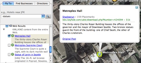
Last week Google added KML search to Google Earth. Now when you are using the search bar you will see a listing of KML files found via web crawl that are applicable to your current Google Earth view. For example, if you are viewing Seattle, WA and you type in 'statues' you will see applicable KML files. When I heard the announcement two things struck me.
Web Search in Keyhole
This is the first inclusion of Google's web crawl in Google Earth. It has had Local search for a while, but that comes from a seperate index. I think that this is just the beginning of different search types to be included in Google Earth. I don't see any reason why Google wouldn't continue to add geocoded content as layers. In the future I think that we can expect blogs, Orkut networks, geo-referenced websites (time to start using microformats!), and books (it has already added a geo-oreinted view to book search - example).
What would the goal be of adding more search types? Well for one this would continue to improve the product; search is powerful. Second, search can lead to ads which may lead to monetization of Google Earth.
Geo Community Centered Around KML
This is the second KML-sharing feature that Google has implemented. The first was the ability to view other people's KML files in Google Maps. Though hosted KML is a very capable for sharing data it is still incredibly geeky to try to build community around a file format. I can't imagine "normal" users being able to really use this.
A much simpler method of sharing would be hosted maps - very similar to what Platial , Frappr and Live do. I have to assume that a similar product is being worked on internally. Google will have to strike a balance here as it will not want to be seen as competing too much with all of its mashup partners (who can switch providers very easily by using Open Source JavaScript libraries like OpenLayers or Mapstraction - Radar post).
John Hanke, the founder of Keyhole (creators of Google Earth), will be speaking at Where 2.0 2007.
tags: web 2.0
| comments: 7
| Sphere It
submit: ![]()
![]()
![]()
![]()
0 TrackBacks
TrackBack URL for this entry: http://blogs.oreilly.com/cgi-bin/mt/mt-t.cgi/5252
Comments: 7
In response to your comment,
"A much simpler method of sharing would be hosted maps - very similar to what Platial , Frappr and Live do. I have to assume that a similar product is being worked on internally."
I have began to build this type of site- pretty much done aside from group maps and embedding for other sites. Let me know what you think, I'd be honored.
is there a way to view google earth in real time? I heard if you bought a membership it was in fifteen minute time delay is that true?
Hi Brad, ahhhh no.
This is a very common misconception of google earth.
It only views historic photos of the earth, they went to a lot of trouble to get static cloud free imagery by combining a large number of separate photo layers. The highly detailed images are often from cameras on planes, and the low res ones are from satellites.
If it helps the Simpsons had a recent show where they made the same (maybe intentional) mistake, it is a classic, find it on youtube.
Andrew.
Rumor: Prior to 911 before goverment control on satelite images the resolution was better and time delay was not as drastic. How much truth is this rumor?
I've been using FriendFeed, a great way to share things with my friends and family. I thought you might like to try it out, too.
Check out my feed here: http://friendfeed.com/dazzo
Post A Comment:
STAY CONNECTED
RECENT COMMENTS
- hrayr on Web Search in Google Earth: I've been using FriendF...
- hrayr on Web Search in Google Earth: you may use HTML tags f...
- mark Pace on Web Search in Google Earth: Rumor: Prior to 911 bef...
- Andrew Russell on Web Search in Google Earth: Hi Brad, ahhhh no. This...
- brad on Web Search in Google Earth: is there a way to view ...
- Kyle on Web Search in Google Earth: In response to your com...
- Mark Harwood on Web Search in Google Earth: Google Earth is missing...
RADAR TOPICS
Mark Harwood [02.22.07 01:48 AM]
Google Earth is missing a major trick which would really open it up.
Right now you can install "network links" - a URL to which GE automatically adds lat/lon parameters for the current window location. This allows you to bring in location-related content but of a fixed subject matter.
Now what if GE did the same thing for HTTP POSTs that it does for HTTP GETs? It has a browser built-in. What if I could display any web page containing a regular form which the user could fill in their choice of subject(item of interest, price range, time range etc) and GE automatically added the current lat/lon data as extra HTTP parameters to define location when posted? How many apps would that enable?
I already floated this on the Keyhole forums some time ago and got a fairly mute response. I have to wonder if Google are wanting to keep that level of "richer" interface limited to a choice of their own services which they currently expose as non-HTML forms inside the GE application.